Translate this page:
| Pincode | 209306 |
| Name | Makrandpur B.O |
| District | Kanpur Dehat |
| State | Uttar Pradesh |
| Status | Branch Office(Delivery) |
| Head Office | Kanpur H.O |
| Sub Office | Rasulabad S.O (Kanpur Dehat) |
| Location | Rasulabad Taluk of Kanpur Dehat District |
| Telephone No | Not Available |
| SPCC | KANPUR HO-208001 |
| Department Info | Kanpur Moffusil Division Kanpur Region Uttar Pradesh Circle |
| Address | Rasulabad, Uttar Pradesh 209306, India |
| Services | |
| Indian Postal Code System Consists of Six digits. The first to digits represent the state, the second two digits represent the district and the Third two digits represents the Post Office.In this case the first two digits 20 represents the state Uttar Pradesh, the second two digits 93 represent the district Kanpur Dehat, and finally 06 represents the Post Office Makrandpur B.O. Thus the Zip Code of Makrandpur B.O, Kanpur Dehat, uttar pradesh is 209306 | |
| Pincode | 242221 |
| Name | Makrandpur B.O |
| District | Shahjahanpur |
| State | Uttar Pradesh |
| Status | Branch Office(Delivery) |
| Head Office | Shahjahanpur H.O |
| Sub Office | Jalalabad S.O (Shahjahanpur) |
| Location | Jalalabad Taluk of Shahjahanpur District |
| Telephone No | Not Available |
| SPCC | Bly-243001 |
| Department Info | Shahjahanpur Division Bareilly Region Uttar Pradesh Circle |
| Address | Jalalabad, Uttar Pradesh 242221, India |
| Services | |
| Indian Postal Code System Consists of Six digits. The first to digits represent the state, the second two digits represent the district and the Third two digits represents the Post Office.In this case the first two digits 24 represents the state Uttar Pradesh, the second two digits 22 represent the district Shahjahanpur, and finally 21 represents the Post Office Makrandpur B.O. Thus the Zip Code of Makrandpur B.O, Shahjahanpur, uttar pradesh is 242221 | |


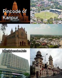
Kanpur (/ˈkÉ‘ËnpÊŠÉ™r/ pronunciation ; formerly Cawnpore; DevanÄgarÄ«: कानपà¥à¤°) is the largest city in the state of Uttar Pradesh in India. It is the administrative headquarters of Kanpur Nagar district and Kanpur division.
Kanpur has an area of over 322 km2 with an approximate population of 5.03 million inhabitants in its area. It is administratively divided into 6 zones and 110 wards with a ward population range of 19,000 to 30,000. It is the 75th largest city in the world.
The name is believed to have derived from Karnapur (meaning "town of Karna", one of the heroes of the Mahabharata). AnotheMore Info